


 349 / 476

339
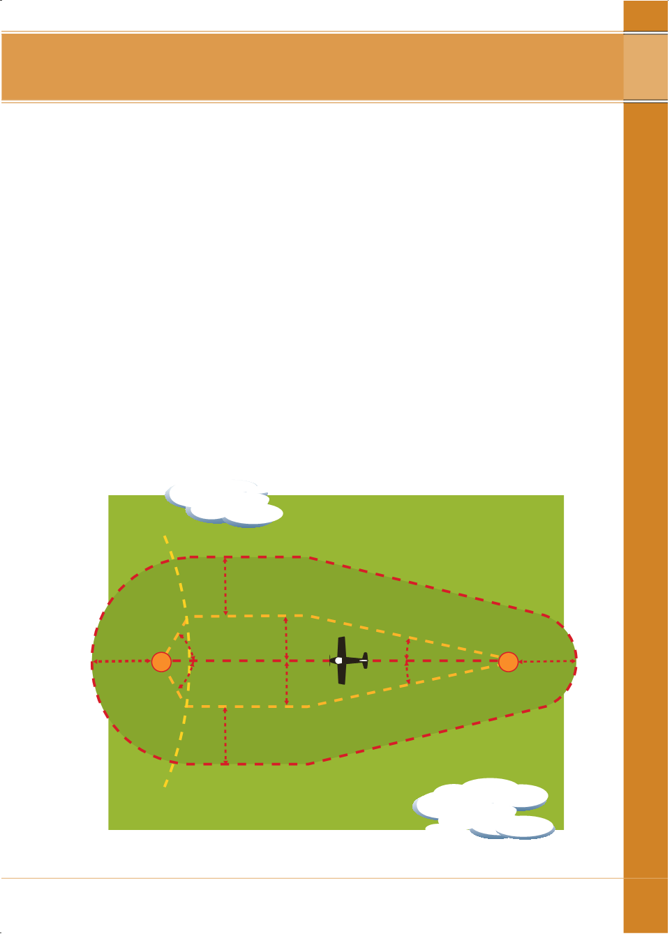
For routes defined by radionavigation aids or tobenavigatedbyDR: the area
to be consideredmust bewithin an area of 5 nm surrounding and including
an area definedby lines drawn from the departurepoint or en route radio aid,
10.3° each side of the nominated track (where the track guidance is provided
by a radio navigation aid), or 15° each side of the nominal track (whereno
track guidance is provided) to a limit of 50 nm each sideof the track, thence
parallelling track to abeam thedestination and then convergingby a semicircle
of 50nm radius centredon thedestination. On shorter routes, where these
lines aredisplaced by less than 50nm abeam the destination, they shall
converge by a radius based on the lesser distance.Where the lines thus
drawn come at any timewithin the coverage of anen route or destination
radio aid the aircraft is equipped to use, theywill converge by straight lines to
that aid. Theminimum angle of convergencewhichmust be used in this case
is 10.3° each side of track.
lowest safe altitude
AID
AID
10.3degrees
10.3degrees
5nm
5nm
50nm
50nm
5nm
5nm
RATEDCOVERAGE
LONGLEG
>10.3degrees
>10.3degrees
LONG LEG - NAVAIDTONAVAID
3 – n i ght v fr